

|
|
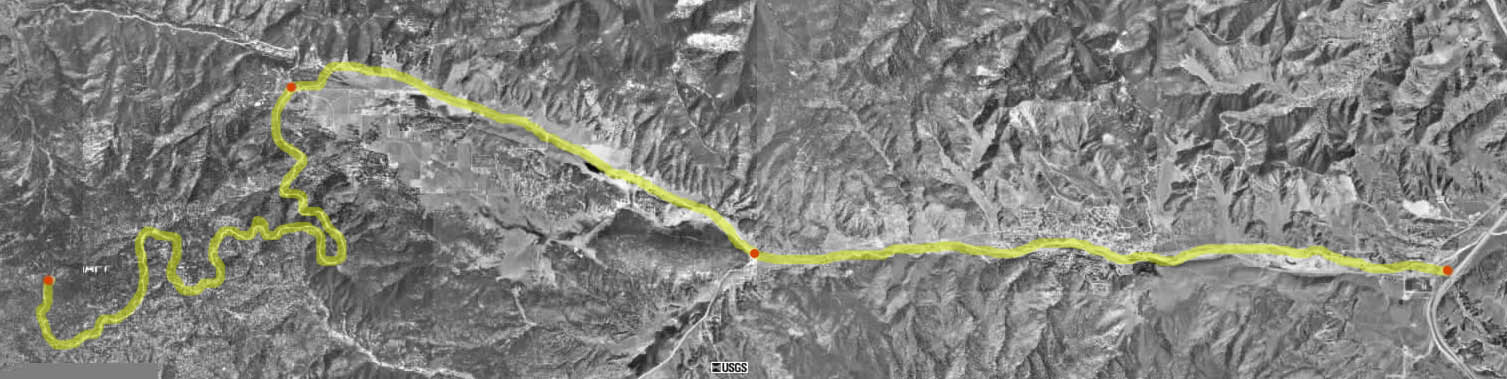
Details About Mount PinosAs one of my favorite deep sky observing sites, I thought I'd donate one page just to Mount Pinos...how to get there, what it looks like when you get there, aerial photos, etc. This page may take a while to load, but it has a wealth of details about this treasure of Southern, CA. The Route from I-5 at the Frazier Park Off ramp, north of Gorman. Right Click and then select "View Image" for the full size picture.
Directions to Mount Pinos From The Los Angeles Area1. Take Interstate 5 north about 34 miles past the Castaic Junction (Magic Mountain). 2. Exit at Frazier Park Road (First red dot on picture, far right). 3. Turn left from the off ramp and drive about 7 or 8 miles. You will go trough a stop sign in the community of Frazier Park and mile or two later, a sign that says "Ranger Station/ Lockwood Valley" with an arrow pointing left (second red dot on picture). Don't turn here, keep going straight another 3-4 miles. 4. You will eventually come to a "Y" intersection (Third red dot on picture ) with a sign with directions to Pine Mountain Club (right) and Mount Pinos (straight), you want to keep going straight. The road to the summit has no markings so if you get past this point and there is a double-yellow line in the road, you're heading towards Pine Mountain Club, not Mount Pinos. 5. Follow this windy road about 8 miles past two yellow, snow gates. One gate is at about 1 mile in or so, the other about 5-6 miles in. 6. Near the end there will be a road sign with the words "pavement ends" on it. The parking lot is just around the corner so slow down a bit. 7. When you see a whole bunch of scopes and RV's, you're there.
This is a shot of the Mount Pinos parking lot from 60,000 ft. Annotations by astro-tom.
Some Suggestions For Visitors
05/25/2015 | |||||||||||||||||||||||||||||||||||||||||||||||||||||||||||||||||||||||||||||||||||||||||||||||||||||||||||||||||||||||||||||||||||||||||
|